Trying to compare Fort Lauderdale waterfront neighborhoods by boat access alone can get confusing fast. A home may look ideal on a map, but your real-world boating experience often comes down to bridge clearances, wake zones, and the route from your dock to open water. If you want to buy with confidence, you need to look beyond the neighborhood name and understand how each area actually works for your vessel and lifestyle. Let’s dive in.
Why route matters most
Fort Lauderdale is built around boating, with 165 miles of navigable waterways and a public marine network tied to the New River, Riverwalk, and the Intracoastal Waterway, according to the City of Fort Lauderdale marinas overview. That is a big reason the city attracts everyone from casual weekend boaters to serious yacht owners.
But when you compare neighborhoods, the smartest question is not simply, “Is it waterfront?” The better question is, “What does the route from this dock look like?” In Fort Lauderdale, your boating experience is shaped by bridge height, no-wake rules, and the location of nearby marinas or ramps.
The NOAA Fort Lauderdale navigation guidance makes that clear. It highlights examples like the Las Olas Boulevard Bridge at 24 feet, the 17th Street bridge at 55 feet, and the Mercedes River bridge at 7 feet, while also noting no-wake restrictions on the New River, Middle River, and Stranahan River.
Fort Lauderdale boating factors
Bridge clearance affects choices
If your boat has meaningful air draft, bridge clearance can quickly narrow your options. A neighborhood may be highly desirable on land, but if your route includes a low fixed bridge, it may not be the right fit for your vessel.
This is especially important for taller boats, including many sailboats, sportfishing boats, and larger yachts. In practical terms, buyers should review both the property and the full water route before deciding a neighborhood is a match.
Wake zones shape daily use
Speed restrictions can change how convenient a location feels over time. In December 2025, the city announced a new slow-speed, minimum-wake zone on the Intracoastal Waterway between the Oakland Park Boulevard Bridge and the Sunrise Boulevard Bridge.
That update matters if you are looking along the beach-side ICW corridor. It overlaps with existing year-round idle-speed and no-wake areas near the bridges, plus a seasonal manatee zone, so some routes are more restricted than the neighborhood label alone might suggest.
Depth is lot specific
One of the biggest mistakes buyers make is assuming there is a reliable neighborhood-wide canal depth. In Fort Lauderdale, public data are much better at confirming route constraints than giving one average depth for an entire neighborhood.
That is why it is safest to treat depth as lot specific and route specific, using verified published examples where available. NOAA supports that approach in its guidance, which is one reason boating-focused home searches here should be highly property specific.
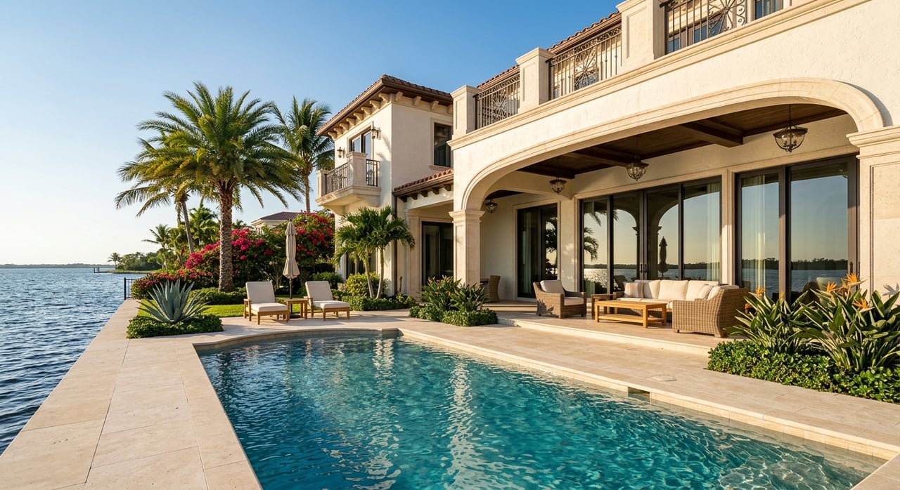
Las Olas Isles and Seven Isles
Best for central boating access
If you want a central, yachting-oriented lifestyle, Las Olas Isles and Seven Isles are among the strongest options. The city groups these areas in an east-side district bordered by the Intracoastal Waterway on the north, east, and west, and by the New River on the south, according to this city district analysis.
This location gives you a very connected boating corridor near Las Olas, downtown, the ICW, and the New River. It also places you close to the city’s boating infrastructure, including Las Olas Municipal Marina and other public marina facilities.
What boaters should watch
The main caution here is still bridge clearance. NOAA reports the Las Olas Boulevard Bridge at 24 feet, and nearby Bahia Mar basin data show published depths of 7 to 14 feet alongside the wharf, with 11 to 5 1/2 feet at finger piers, based on the same NOAA navigation document.
For many buyers, this area works well because it blends lifestyle and boating convenience. Still, if your vessel has notable air draft or draft requirements, you will want to confirm the exact route from the specific property.
Rio Vista
Best for New River access
Rio Vista appeals to buyers who want character, central convenience, and a strong relationship to the river. The city says the neighborhood is bounded by U.S. 1 on the west, the Intracoastal Waterway on the east, the New River on the north, and SE 12th Street on the south in its Rio Vista area survey.
From a boating standpoint, Rio Vista is more river-oriented than some other core waterfront neighborhoods. That can be a plus if you enjoy the New River setting and want quick access to downtown-adjacent water routes.
What boaters should watch
The tradeoff is bridge interaction and slower running. NOAA describes the New River as the main navigation channel in the area, notes that speed is limited to no wake, and lists several relatively low bridge clearances farther inland, including 16 feet at SE Third Avenue, 21 feet at South Andrews Avenue, 20 feet at the William H. Marshall Memorial Bridge, and 21 feet at SW 12th Street.
NOAA also notes strong currents near Tarpon Bend, which adds another operational factor for some boaters. The city’s Tarpon River restoration project in Rio Vista further confirms the neighborhood’s active waterway setting, including dredging around the SE 9 Avenue Bridge.
Bay Colony
Best for north-end canal-front searches
Bay Colony is a strong neighborhood to consider if you want a north-end waterfront setting. It appears within the city’s Coral Ridge North-Imperial Point district, alongside other waterfront associations and communities in this official district analysis.
For buyers, the appeal is straightforward: canal-front living in a well-known north Fort Lauderdale waterfront area. It can be a strong option if you are open to a more tailored, property-by-property search rather than expecting one uniform boating profile.
What boaters should watch
Bay Colony is a good example of why the neighborhood name is only part of the story. City project documents place the neighborhood on Bayview Drive south of the Bay Colony Drive bridge and confirm canal-side seawall work from a barge in the canal east of Bayview Drive in this city project update.
That confirms waterfront conditions, but it does not provide a standardized public depth figure for the entire neighborhood. Here, more than almost anywhere, you will want to verify the lot’s canal depth and the bridge path for the exact property you are considering.
Coral Ridge areas
Best for variety and ramp access
Coral Ridge is better understood as a group of subareas than one single boating neighborhood. The city separates Coral Ridge into multiple waterfront-adjacent districts, including the Coral Ridge North-Imperial Point district and the Coral Ridge South-Lauderdale Beach district, as shown in the same city neighborhood analysis.
That matters because boating conditions and access can vary significantly depending on the section. For buyers who want more choices in lot types, water frontage, and nearby launch options, Coral Ridge deserves a close look.
What boaters should watch
A useful advantage in this area is public launch access. George English Park on Bayview Drive offers a boat ramp, canoe and kayak landing, and fishing access, and the city says the ramps are designed for vessels with up to 10 feet, 3 inches of vertical clearance under the Sunrise Boulevard Bridge over Middle River, with capacity for up to four 35-foot vessels at a time.
At the same time, boaters should note route restrictions. Coral Ridge sits near the Intracoastal corridor now affected by the city’s new slow-speed, minimum-wake zone, and NOAA says Middle River is no wake from a point 1 mile above the Sunrise Boulevard Bridge. In other words, Coral Ridge offers flexibility, but it is not the simplest no-bridge boating story.
Harbor Beach and Harbor Inlet
Best for beach-adjacent boating lifestyle
If your priority is a private, beach-adjacent waterfront setting, Harbor Beach and Harbor Inlet stand out. The city’s Harbor Beach district includes Harbor Beach HOA, Harbor Inlet Association, Breakwater Surf Homes, Harbor Drive Association, and Harbor Isles of Fort Lauderdale, with boundaries that include the Intracoastal Waterway and the Atlantic, according to this city district document.
This is one of the most distinct lifestyle options in the city for boaters who also want a strong connection to the beach and inlet area. The setting feels more peninsula-like than some of the more central neighborhoods.
What boaters should watch
The key caution is route clearance. The city says the West Lake Drive bridge is the only way into the Harbor Beach residential community in this Harbor Beach traffic document, and NOAA identifies the bridge over the Mercedes River as a fixed span with 7 feet of clearance.
NOAA also reports about 8 feet of controlling depth on the Mercedes River from the waterway to the bridge, with a nearby marina reporting 15 to 4 1/2 feet alongside piers and bulkheads. For that reason, Harbor Beach is often an excellent lifestyle fit, but not automatically the right boating fit for taller-air-draft vessels.
Quick comparison for boaters
| Neighborhood | Best for | Main boating watch-out |
|---|---|---|
| Las Olas Isles / Seven Isles | Central yachting lifestyle | Bridge clearance must be checked property by property |
| Rio Vista | New River cruising and central location | More bridges, no-wake running, river currents |
| Bay Colony | North-end canal-front homes | Lot-specific depth and route verification |
| Coral Ridge areas | Broad search options and ramp access | Mixed route conditions and speed restrictions |
| Harbor Beach / Harbor Inlet | Private beach-adjacent boating lifestyle | Very low bridge on Mercedes River route |
How to choose the right fit
The best Fort Lauderdale waterfront neighborhood for boating depends on how you actually use your vessel. A buyer with a runabout or smaller powerboat may prioritize neighborhood setting and dockage, while a buyer with more air draft may focus first on bridge clearance.
It also helps to think in terms of daily experience. Do you want a central lifestyle near Las Olas, a New River setting, a north-end canal-front location, or a beach-adjacent address near the inlet? In Fort Lauderdale, those lifestyle goals are closely tied to route planning.
A smart search usually starts with three things:
- Your boat’s air draft
- Your boat’s draft
- Your preferred cruising style and typical route
From there, you can match the vessel to the neighborhood, then narrow down to the specific streets and homes that make operational sense.
If you are weighing waterfront options in Fort Lauderdale, a property search should always include the boating route, not just the home itself. For tailored guidance on luxury waterfront opportunities and a more strategic property shortlist, you can connect with Brady Thrasher for a private consultation.
FAQs
Which Fort Lauderdale waterfront neighborhood is best for larger boats?
- For many buyers, Las Olas Isles and Seven Isles are strong options because of their central boating access, but the right fit still depends on the exact property route, bridge clearances, and lot-specific conditions.
Which Fort Lauderdale boating neighborhood has the most bridge restrictions?
- Rio Vista and Harbor Beach both require close attention to bridges, with NOAA noting several lower-clearance bridges along New River routes and a 7-foot fixed bridge over the Mercedes River for Harbor Beach access.
Which Fort Lauderdale neighborhood is best for New River boating?
- Rio Vista is one of the clearest choices for buyers who want a New River-oriented setting with central access, though you should expect no-wake operation and more bridge interaction.
Which Fort Lauderdale waterfront area is best for a beach-adjacent lifestyle?
- Harbor Beach and Harbor Inlet stand out for buyers who want a private waterfront setting near the beach and inlet, but route verification is essential before choosing a property for a specific vessel.
Do Fort Lauderdale waterfront neighborhoods have standard canal depths?
- No. Public sources are generally more reliable for route constraints, bridge clearances, and wake zones than for neighborhood-wide average canal depths, so depth should be evaluated property by property.
Where can you launch a boat in the Coral Ridge area?
- George English Park offers a public boat ramp, canoe and kayak landing, and fishing access, with city guidance noting vertical clearance limits under the Sunrise Boulevard Bridge for vessels using the ramps.